Official Name:
河南村土墙HeNanCunTuQiangOur Name:
老边岗,边岗道 老边岗,边岗道 / LaoBianGangBianGangDaoLaoBianGangBianGangDao
Other Name:
/
Period:唐 / Tang Dynasty 618~907
Location: 吉林省,四平市,公主岭市,起点:怀德镇新三道岗村边西屯屯南。止点:怀德镇河南村南六百米双西乙高压输送线路325电塔东南50米。 / JiLinSheng,SiPingShi,GongZhuLingShi,QiDianHuaiDeZhenXinSanDaoGangCunBianXiTunTunNanZhiDianHuaiDeZhenHeNanCunNanLiuBaiMiShuangXiYiGaoYaShuSongXianLu325DianTaDongNan50Mi
[
Looking Local List]
Details:长城类别:墙体
起点经纬高度:东经:124° 41′ 北纬:43° 52′ 海拔:196
终点经纬高度:东经:124° 41′ 北纬:43° 50′ 海拔:175
墙体走向:此段长城自怀德镇新三道岗村边西屯屯南至怀德镇河南村一队南一千米双西乙高压输送线路325电塔东南50米,为西北-东南走向。
墙体类别:土墙
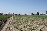
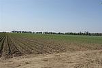
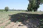
结构特点及构筑方式:因自然和人为因素的破坏,墙体顶部和两侧受损,原始外观形状和顶宽、基宽数据已经无法获知,从现状观察GPS0029-GPS0037之间墙体剖面为上小下大的梯形,其中GPS0029-GPS0030,底宽40米左右,顶宽35米左右,残高0.3-0.5米,GPS0031-GPSOO32,底宽35米左右,顶宽32米左右,残高0.3-0.5米,GPS0033-GPS0034,底宽40米左右,顶宽35米左右,残高0.3-0.5米。
采集标本的概括性说明:无。墙体为单条隆起的土垄。
现状:土墙,从现状观察墙体大部分为纯净黑土构筑。
Type:土墙 Rammed earth wall
Protection Level:国保
Content:
Memo:
Other Records:
Distribution:
visit location in Tianditu Map[recommend] Distribution:
visit location in Tencent QQ Map Distribution:
visit location in Google MapDistribution:
visit location in Baidu MapNational ID:220381382101120009
Action:[
 Save in Data Basket
 ]
Picture:
Click the thumbnail to view the Big Pic. Click the Big Pic to Hide the Big Pic![Caption:河南村土墙
loading images --Please wait...]()
![Caption:河南村土墙
loading images --Please wait...]()
![Caption:河南村土墙
loading images --Please wait...]() Photo Links
Photo Links:
 Search ::
  My Data Basket ::
  Favorite/My Favorite :: Recent Changes :: :: Login
 Save in Data Basket ]

