Official Name:
沈家屯土墙ShenJiaTunTuQiangOur Name:
边岗、老壕道 边岗、老壕道 / BianGangLaoHaoDaoBianGangLaoHaoDao
Other Name:
/
Period:唐 / Tang Dynasty 618~907
Location: 吉林省,四平市,梨树县,起点:梨树镇北夏家村沈家屯西南100米的树林带。止点:梨树镇泉眼沟村王家屯西南250米的“石东线”公路南侧。 / JiLinSheng,SiPingShi,LiShuXian,QiDianLiShuZhenBeiXiaJiaCunShenJiaTunXiNan100MiDeShuLinDaiZhiDianLiShuZhenQuanYanGouCunWangJiaTunXiNan250MiDeShiDongXianGongLuNanCe
[
Looking Local List]
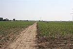
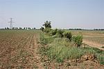
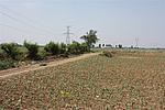
Details:长城类别:墙体
起点经纬高度:东经:124° 25′ 北纬:43° 18′ 海拔:179
终点经纬高度:东经:124° 24′ 北纬:43° 17′ 海拔:191
墙体走向:该段墙体起于北夏家村沈家屯东南300米的树林带(GPS0276),止于梨树镇泉眼沟村王家屯西南250米的“石东线”公路南侧(GPS0280),整体为东北-西南走向。
墙体类别:土墙
结构特点及构筑方式:因自然和人为因素的破坏,墙体顶部和两侧受损,原始外观形状和顶宽、基宽数据已经无法获知。据现存状况观察GPS0277至GPS0278区间墙体剖面为上小下大的梯形,宽0.5-1.5米、高1.0-1.5米。
采集标本的概括性说明:无。墙体为单条隆起的土垄。
现状:土墙。从现状观察墙体大部分为纯净黑土构筑。
Type:土墙 Rammed earth wall
Protection Level:国保
Content:
Memo:
Other Records:
Distribution:
visit location in Tianditu Map[recommend] Distribution:
visit location in Tencent QQ Map Distribution:
visit location in Google MapDistribution:
visit location in Baidu MapNational ID:220322382101120014
Action:[
 Save in Data Basket
 ]
Picture:
Click the thumbnail to view the Big Pic. Click the Big Pic to Hide the Big Pic![Caption:沈家屯土墙
loading images --Please wait...]()
![Caption:沈家屯土墙
loading images --Please wait...]()
![Caption:沈家屯土墙
loading images --Please wait...]() Photo Links
Photo Links:
 Search ::
  Favorite/My Favorite :: Recent Changes :: :: Login