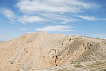
Official Name:
小马湾烽火台XiaoMaWanFengHuoTaiOur Name:
/
Other Name:
/
Period:明 / Ming Dynasty 1368~1644
Location: 宁夏回族自治区,中卫市,海原县,关桥镇小马湾村北0.2千米 / NingXiaHuiZuZiZhiQu,ZhongWeiShi,HaiYuanXian,GuanQiaoZhenXiaoMaWanCunBei02QianMi
[
Looking Local List]
Details:长城类别:单体建筑
经纬高度:东经:105° 44′ 北纬:36° 47′ 海拔:1571
建筑形式:该烽火台建于较为平缓的土山坡上。
修筑方法为,先用黄沙土夯筑烽火台台体,再用黄沙土夯筑围墙。
材料:烽火台台体及围墙均是用黄沙土夯筑而成,均为就地取材,烽火台建于较为平缓的土山坡上。
附近遗存:西南距王湾烽火台1590米。
Type:烽火台 Beacon Tower
Protection Level:省保
Content:
Memo:
Other Records:
Distribution:
visit location in Tianditu Map[recommend] Distribution:
visit location in Tencent QQ Map Distribution:
visit location in Google MapDistribution:
visit location in Baidu MapNational ID:640522353201170005
The original number submitted by the local government :640522353201170008
(when the Great Wall is identified, the data whose code has been adjusted will display the original number submitted by the local government before revision, which can be used by the local cultural relics department when checking the local data.)
Action:[
 Save in Data Basket
 ]
Picture:
Click the thumbnail to view the Big Pic. Click the Big Pic to Hide the Big Pic![Caption:小马湾烽火台
loading images --Please wait...]() Photo Links
Photo Links:
 Search ::
  My Data Basket ::
  Favorite/My Favorite :: Recent Changes :: :: Login
 Save in Data Basket ]