Official Name:
华藏寺长城HuaCangSiChangChengOur Name:
边墙 / BianQiang
Other Name:
/
Period:明
/ Ming Dynasty 1368~1644
Location: 甘肃省,武威市,天祝藏族自治县,起点:华藏寺镇界碑村四组耕地中(天祝县与永登县交界处的高速公路东侧约50米)止点:华藏寺镇华藏寺村水泉九组东300米水泉墩 / GanSuSheng,WuWeiShi,TianZhuCangZuZiZhiXian,QiDianHuaCangSiZhenJieBeiCunSiZuGengDiZhong(TianZhuXianYuYongDengXianJiaoJieChuDeGaoSuGongLuDongCeYue50Mi)ZhiDianHuaCangSiZhenHuaCangSiCunShuiQuanJiuZuDong300MiShuiQuanDun
[
Looking Local List]
Details:长城类别:墙体
起点经纬高度:东经:103° 08′ 北纬:36° 57′ 海拔:2371
终点经纬高度:东经:103° 07′ 北纬:37° 00′ 海拔:2453
墙体走向:
墙体类别:消失的长城
结构特点及构筑方式:无。不详。
该段墙体起自第0001点,止于第0002点,全长5240米。
该段墙体全部消失。止点东距金强河约100米,西距水泉组居民地300米,西南距甘新(312国道)公路、兰新铁路约500米,东北与水泉墩(敌台)相接。
现状:此段墙体全部消失,起点为一耕地田埂,经当地老乡指认才得以确认长城的位置和大致走向。
Type:消失的长城 Disappeared wall
Protection Level:
Content:
Memo:
Other Records:
Distribution:
visit location in Tianditu Map[recommend] Distribution:
visit location in Tencent QQ Map Distribution:
visit location in Google MapDistribution:
visit location in Baidu MapNational ID:620623382301170001
Action:[
 Save in Data Basket
 ]
Picture:
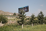
Click the thumbnail to view the Big Pic. Click the Big Pic to Hide the Big Pic![Caption:华藏寺长城
loading images --Please wait...]()
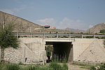
![Caption:华藏寺长城
loading images --Please wait...]() Photo Links
Photo Links:
 Search ::
  Favorite/My Favorite :: Recent Changes :: :: Login