Official Name:
十八里汰烽火台ShiBaLiTaiFengHuoTaiVersion Notes:
This is the lastest Page, You can visit the Page's History.Our Name:
炮台、狼烟墩、墩台、敖包 / PaoTaiLangYanDunDunTaiAoBao
Other Name:
/
Period:汉 / Han Dynasty 206 B.C.~316A.D.
Location: 河北省,承德市,隆化县,隆化县韩麻营镇十八里汰村东约1.0千米 / HeBeiSheng,ChengDeShi,LongHuaXian,LongHuaXianHanMaYingZhenShiBaLiTaiCunDongYue10QianMi
[
Looking Local List]
Details:长城类别:单体建筑
经纬高度:东经:117° 49′ 北纬:41° 17′ 海拔:679
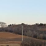
建筑形式:烽火台位于一条东北-西南走向的山梁上。东西为缓坡,种植有刺槐和油松。南距铁路约1.0千米,南1.5千米为承围公路(新线)。公路南为十八里汰河。西约1.0千米处有废弃军营,现为民用。烽火台现为圜丘状,四面呈斜坡。黄土夯筑,形体较大,顶平,近人挖有环形壕沟,宽0.60米,底径14.2米。南侧存高4.7米。西北角底部有一个盗洞,宽长深米。
材料:黄土
附近遗存:东南约3.1千米为韩麻营烽火台,西北约1.9千米为牌岔子烽火台。
Type:烽火台 Beacon Tower
Protection Level:省保
Content:
Memo:
Other Records:
Distribution:
visit location in Tianditu Map[recommend] Distribution:
visit location in Tencent QQ Map Distribution:
visit location in Google MapDistribution:
visit location in Baidu MapNational ID:130825353201040009
Action:[
 Save in Data Basket
 ]
Picture:
Click the thumbnail to view the Big Pic. Click the Big Pic to Hide the Big Pic![Caption:IMG_20250118_200514.jpg
loading images --Please wait...]() Photo Links
Photo Links:
 Search ::
  My Data Basket ::
  Favorite/My Favorite :: Recent Changes :: :: Login
 Save in Data Basket ]