Official Name:
碾子沟炮台梁烽火台NianZiGouPaoTaiLiangFengHuoTaiVersion Notes:
This is the lastest Page, You can visit the Page's History.Our Name:
炮台、狼烟墩、墩台、敖包 / PaoTaiLangYanDunDunTaiAoBao
Other Name:
/
Period:汉 / Han Dynasty 206 B.C.~316A.D.
Location: 河北省,承德市,隆化县,隆化县隆化镇伊逊河沟村碾子沟自然村东南约320米 / HeBeiSheng,ChengDeShi,LongHuaXian,LongHuaXianLongHuaZhenYiXunHeGouCunNianZiGouZiRanCunDongNanYue320Mi
[
Looking Local List]
Details:长城类别:单体建筑
经纬高度:东经:117° 45′ 北纬:41° 19′ 海拔:710
建筑形式:烽火台北依松林,东、南、西为陡坡,西侧有人行小道。北约1.0千米为骆驼峰山,南侧山下为承围公路。西距隆化县城约3.5千米。西北约2.5千米为伊逊河。北约0.5千米为伊逊河沟,沟谷中有水泥路。西北约0.8千米为承德御室金丹药厂。台体北侧为大片松林,有5株树径较大。东北约0.2千米处有高压电塔一座。
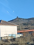
烽火台黄土夯筑,现为圜丘状土堆,坍塌严重。顶径4.7米,底径10米,西侧存高3米。
此台位置为隆化县城周边重要制高点之一,向东可望伊逊河烽火台,向北可望漠海沟、水泉、西沟门等多处烽火台。西约2.0千米为隆化下洼子鲍家营古城址。
材料:黄土
附近遗存:此台位置为隆化县城周边重要制高点之一,向东可望伊逊河烽火台,向北可望漠海沟、水泉、西沟门等多处烽火台。西约2.0千米为隆化下洼子鲍家营古城址。
Type:烽火台 Beacon Tower
Protection Level:省保
Content:
Memo:
Other Records:
Distribution:
visit location in Tianditu Map[recommend] Distribution:
visit location in Tencent QQ Map Distribution:
visit location in Google MapDistribution:
visit location in Baidu MapNational ID:130825353201040013
Action:[
 Save in Data Basket
 ]
Picture:
Click the thumbnail to view the Big Pic. Click the Big Pic to Hide the Big Pic![Caption:IMG20250118155056.jpg
loading images --Please wait...]() Photo Links
Photo Links:
 Search ::
  My Data Basket ::
  Favorite/My Favorite :: Recent Changes :: :: Login
 Save in Data Basket ]